
MIAMI VALLEY — Parts of the region could see strong to severe storms this week.
[DOWNLOAD: Free WHIO-TV News app for alerts as news breaks]
Storm Center 7 continues to TRACK this system. They have the latest TIMING and IMPACTS tonight on News Center 7 at 5:00, 5:30, 6:00, and 11:00.
TRENDING STORIES:
- Car rear-ends motorcyclist, then runs them over
- Area sheriff’s office mourning death of veteran deputy
- The mystery caller to Shedeur Sanders during NFL Draft was the son of NFL coach
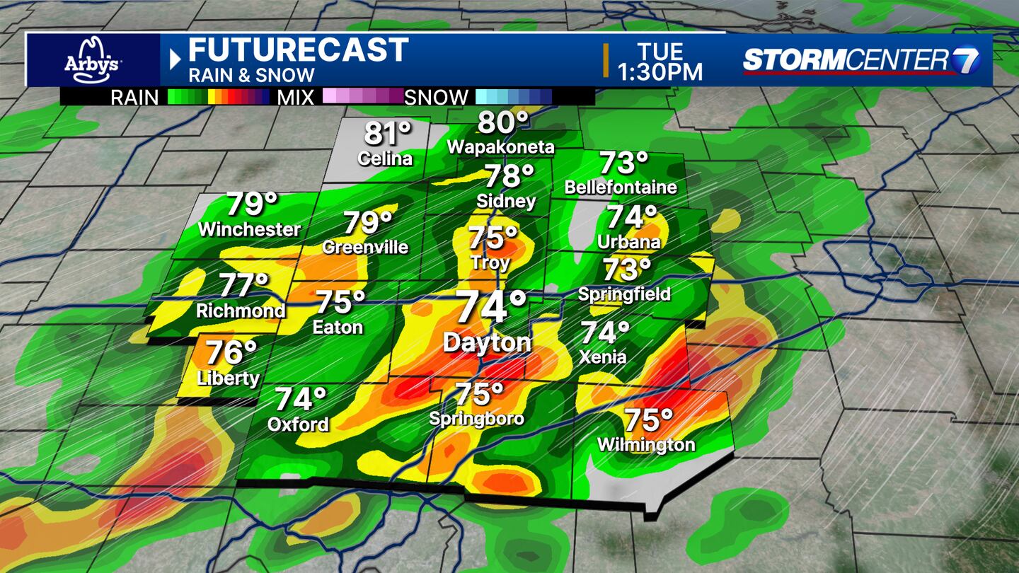
Clouds will increase on Tuesday with showers and thunderstorms becoming likely.
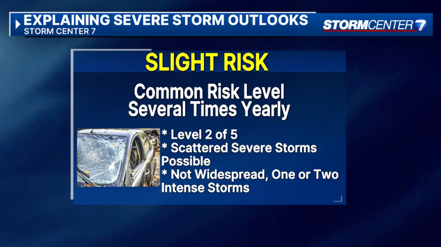
Storm Center 7 Chief Meteorologist Austin Chaney says the Storm Prediction Center (SPC) has much of the Miami Valley under Level 2 (Slight) Risk for Severe weather.
However, eastern Champaign, Clark, Clinton, and Greene counties are under a Level 3 (Enhanced) Risk.
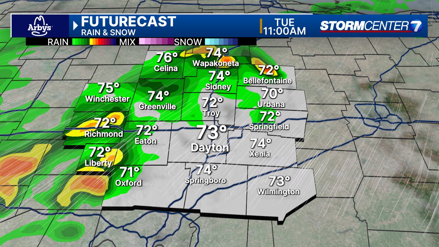
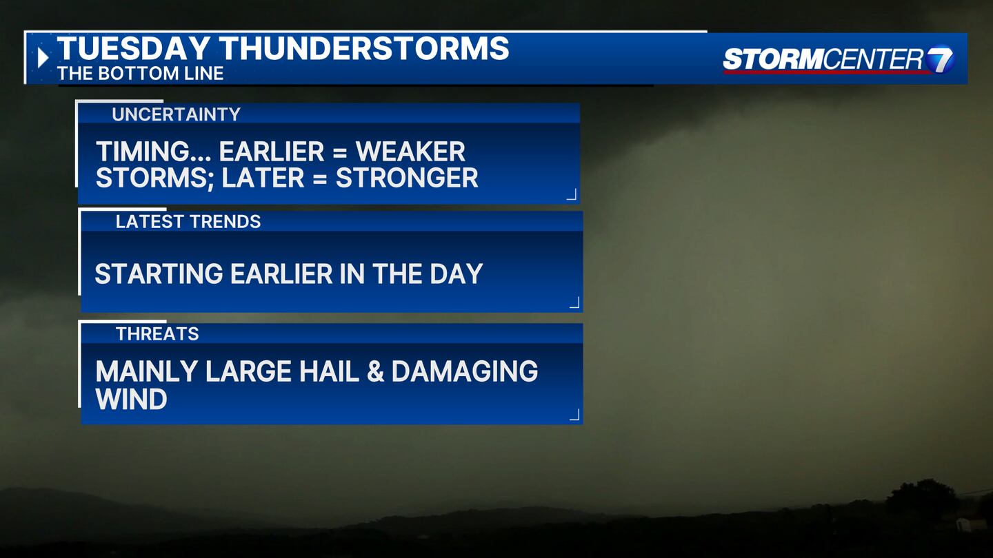
The timing looks to be during the late morning with storms exiting by the early evening. Chaney noted that timing could change.
Chaney states that damaging winds and large hail with strong to severe storms are the main risks currently, but does not rule out a brief tornado.
We will see highs reach to upper 70s to the lower 80s on Tuesday.
Storm Center 7 will continue to update this story.
[SIGN UP: WHIO-TV Daily Headlines Newsletter]
©2025 Cox Media Group
 Sign Up

