
DAYTON — Hurricane Erin, the 2025 season’s first major hurricane, strengthened quickly into a Category 5 storm over the past several days, but as of Tuesday afternoon has encountered some dry air and has weakened into a Category 2 storm with winds of 105 miles per hour.
[DOWNLOAD: Free WHIO-TV News app for alerts as news breaks]
TRENDING STORIES:
- Brio abruptly closes area’s only location; Neighbors worried for shopping center’s future
- Local district forced to make adjustments to accommodate rising enrollment after failed bond issue
- Local school supply store announces upcoming closure, offers discounts
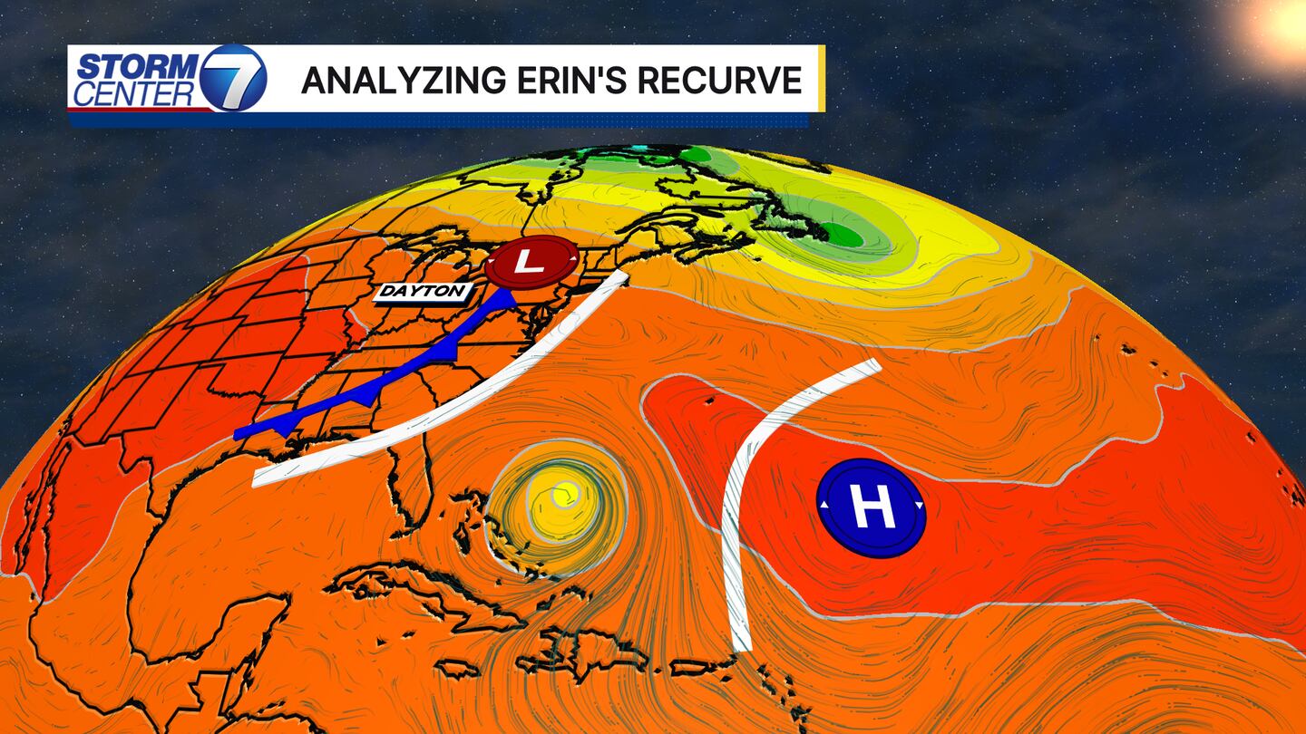
Notice the historical line that the storm has made a significant turn from heading west to almost directly north. This is due to the steering mechanisms in the atmosphere. The subtropical ridge is a large area of high pressure in the middle of the Atlantic Ocean.

That acts like a blocking wall that the hurricane doesn’t want to enter; instead, it moves around it. Luckily, the subtropical ridge is in a weakened state and is allowing the storm to recurve before hitting land.
The other component not letting Hurricane Erin make landfall in the United States is the cold front that’s moving over us. This acts like a separate wall that pushes Erin out to see and helps recurve it to the north.
There will still be impacts across the United States. Dangerous rip currents and rough seas will be up and down the entire East Coast as Erin moves on by.
Even tropical storm force watches and warnings are in effect from coastal Maryland down through most of the North Carolina coast. This is for wind gusts upwards of 60 miles per hour and seas as high as 23 feet across coastal waters, according to the National Weather Service.
We will not see any impacts here in the Miami Valley from Hurricane Erin.
[SIGN UP: WHIO-TV Daily Headlines Newsletter]
©2025 Cox Media Group
 Sign Up

