
MIAMI VALLEY — The next big system’s impacts and payoff are just on our doorstep.
[DOWNLOAD: Free WHIO-TV News app for alerts as news breaks]
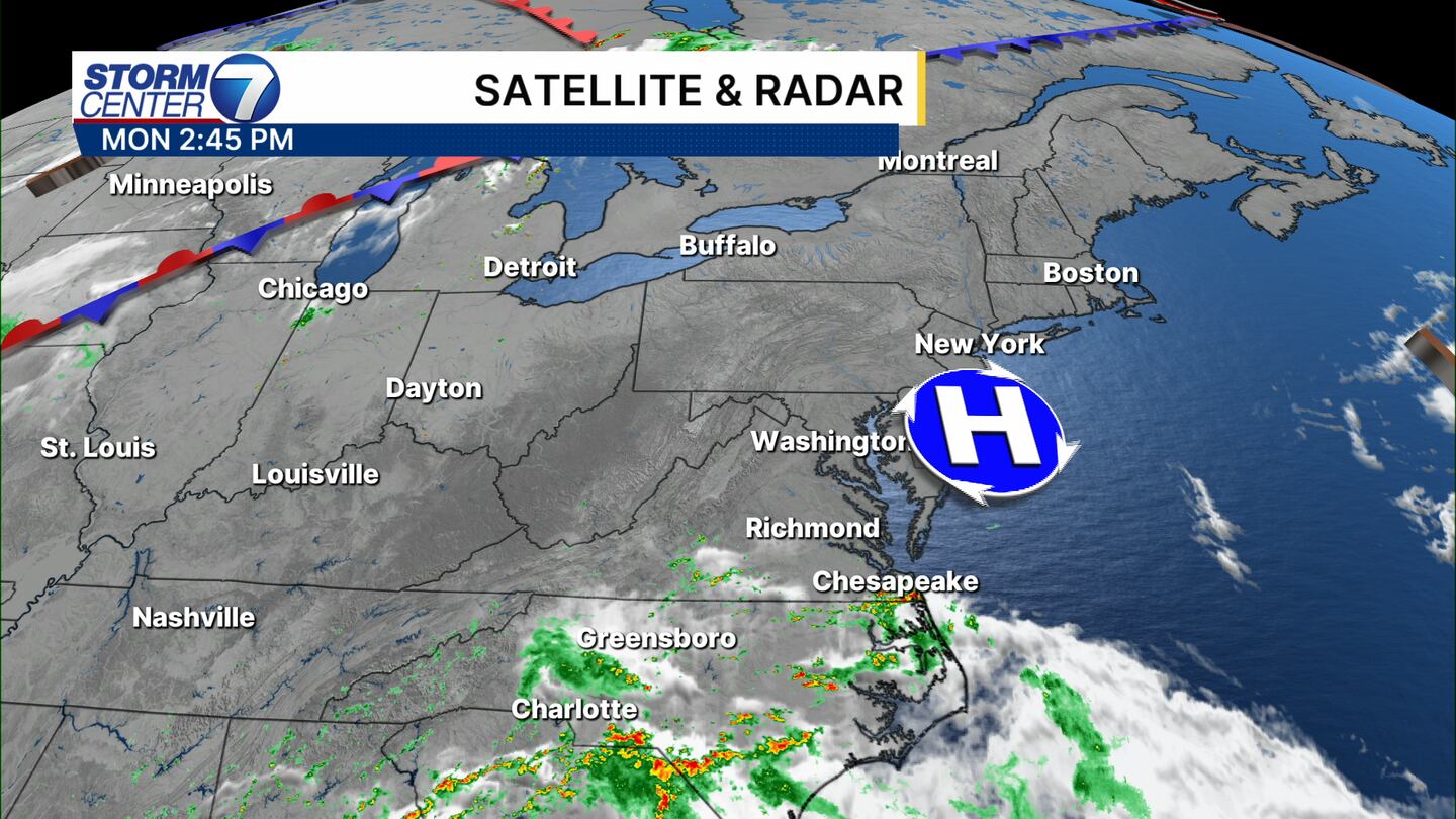
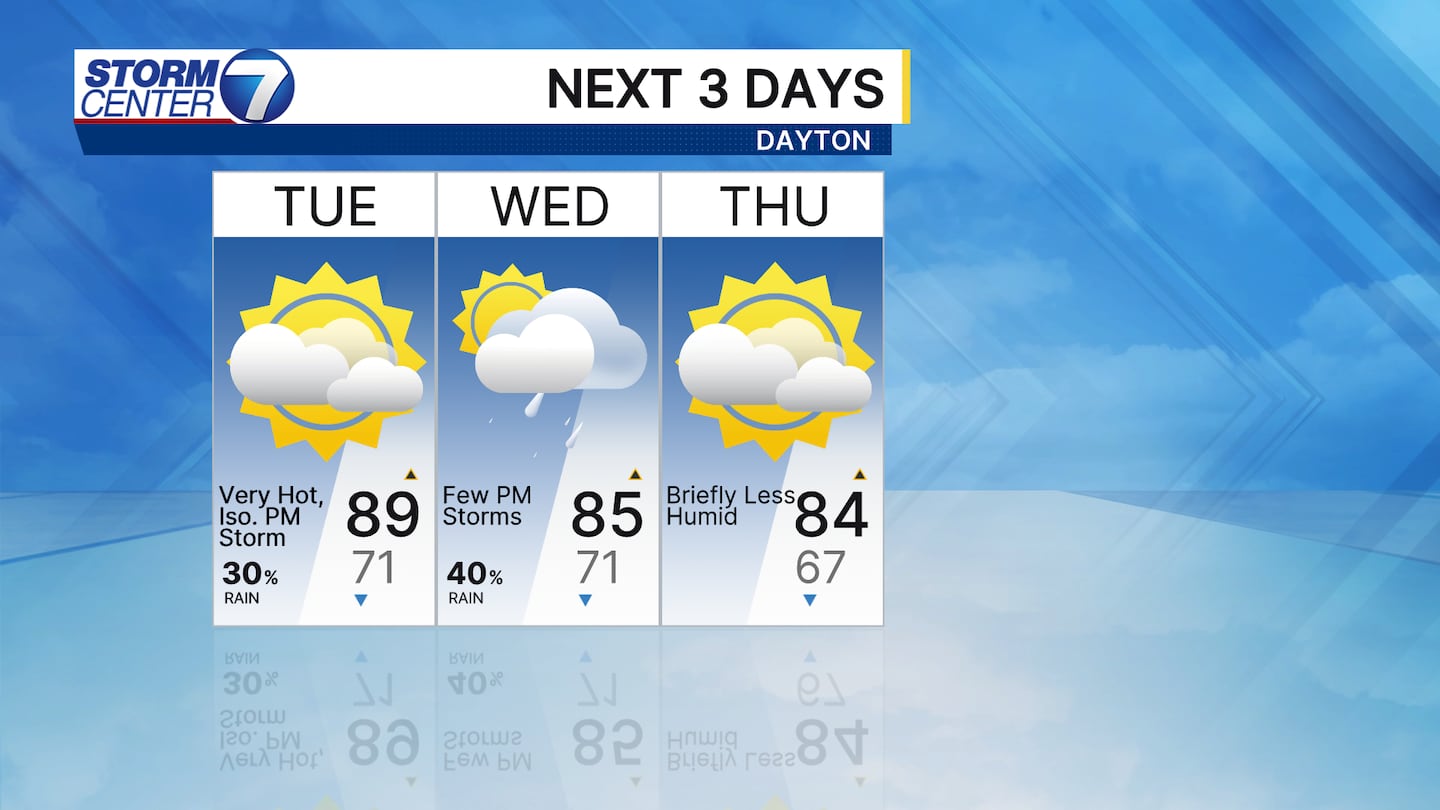
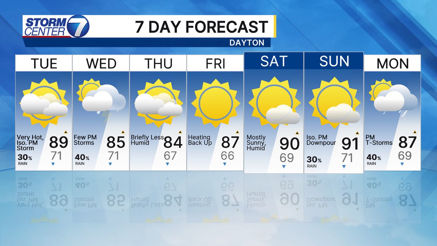
The high pressure over Delaware on Monday is causing our winds in the Miami Valley to come from the southeast, which means it stays hot and humid on Tuesday, according to Storm Center 7 Meteorologist Ryan Marando.
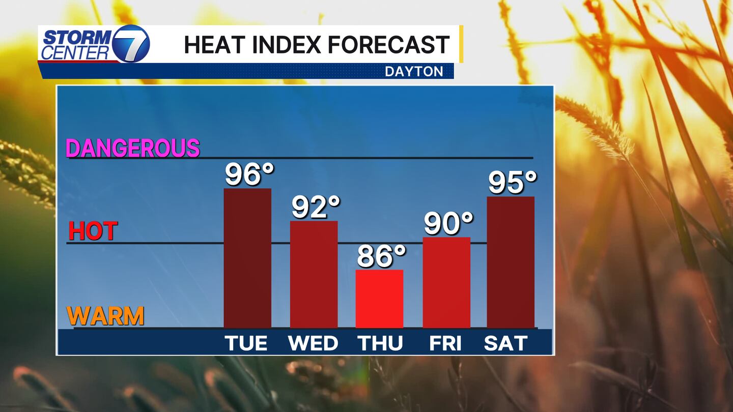
Feels like temperatures for everyone will once again reach into the mid-90s.
TRENDING STORIES:
- Man found in sewer drain after large search forces shelter-in-place in Montgomery County
- Former police officer, champion shooter arrested on child porn charges
- Child safe, 1 person in custody after ‘attempted abduction’ in Springfield
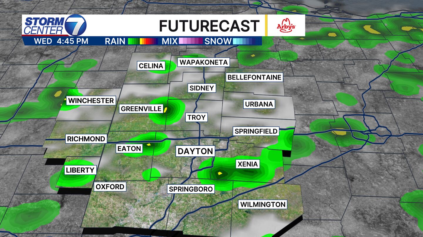
A stationary front just to the west of us here in Ohio will bring thunderstorm energy and a cold front during the afternoon on Wednesday, Marando said.
This will spark scattered coverage of showers and storms, meaning many areas also won’t see rain.
For the areas that do, the downpours could be rather heavy at times.
Some of these storms could also come with some gusty winds, but we are not tracking anything severe as of Monday afternoon.
Then, the payoff arrives briefly. Thursday will have slightly lower humidity and cooler temperatures in the mid to low 80s.
That’s thanks to the winds coming out of the north after this cold front passes through. But the heat and humidity ramp right back up Friday and through the weekend.
Also, remember that the August sun reaches the UV index in the “very high” category, and you could get a sunburn in as little as 20 minutes in direct sunlight.
[SIGN UP: WHIO-TV Daily Headlines Newsletter]
©2025 Cox Media Group
 Sign Up

