
DAYTON — Happy Friday, everyone! Weather Specialist Nick Dunn here with great news to deliver for those who like cool and sunny weekends! As we move into the upcoming holiday weekend, we have dry weather in store all weekend. High pressure is in control, and that means we have no chance for rain and below normal high temperatures.
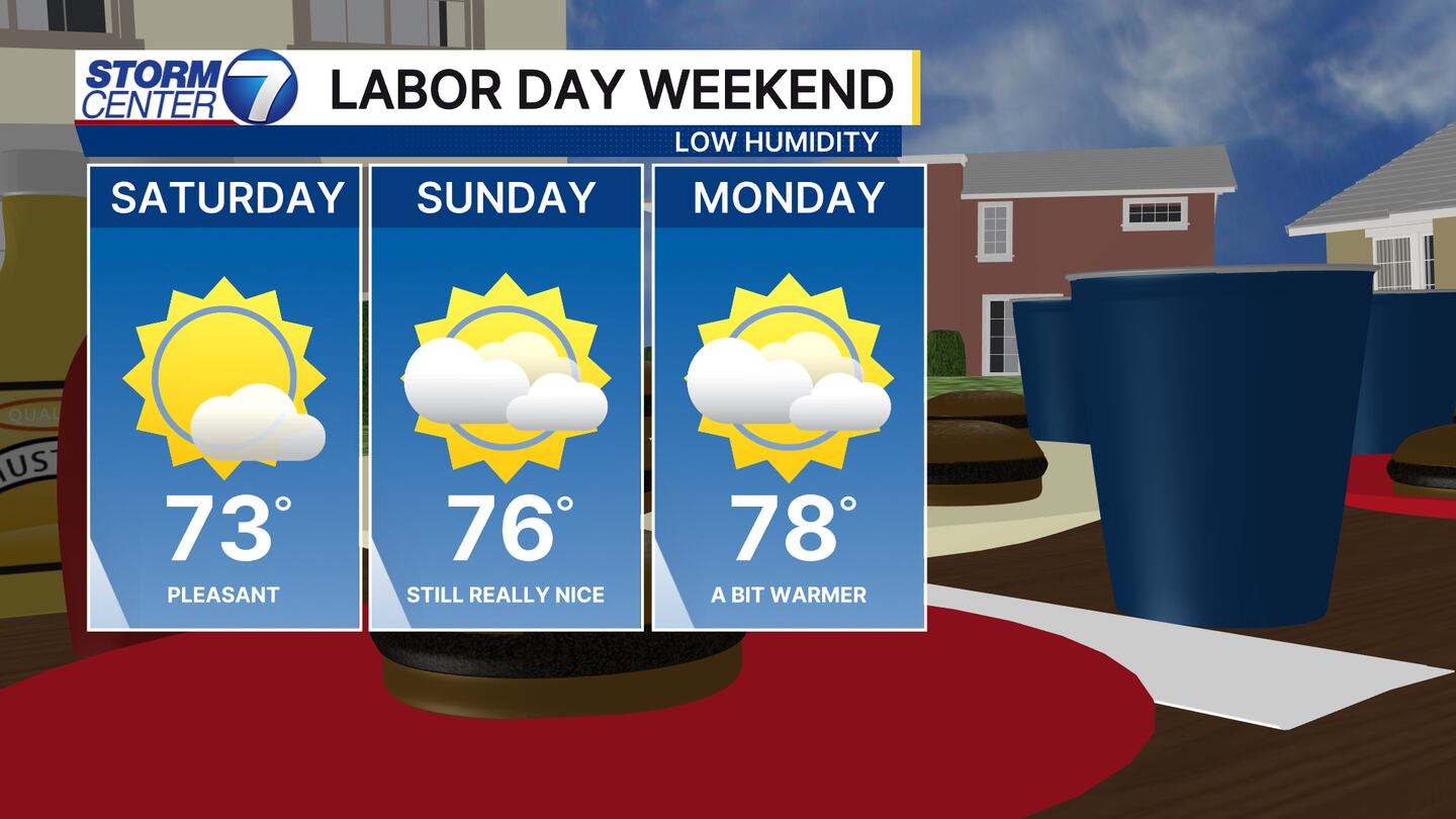
Highs will slowly warm a bit by the time we reach Labor Day, but the trend will be for highs to stay 5-10 degrees below normal through the weekend.
[DOWNLOAD: Free Storm Center 7 Weather app for alerts as news breaks]
I know yesterday’s rainfall was less than impressive and more of us need some. The next impactful system will arrive by midweek!
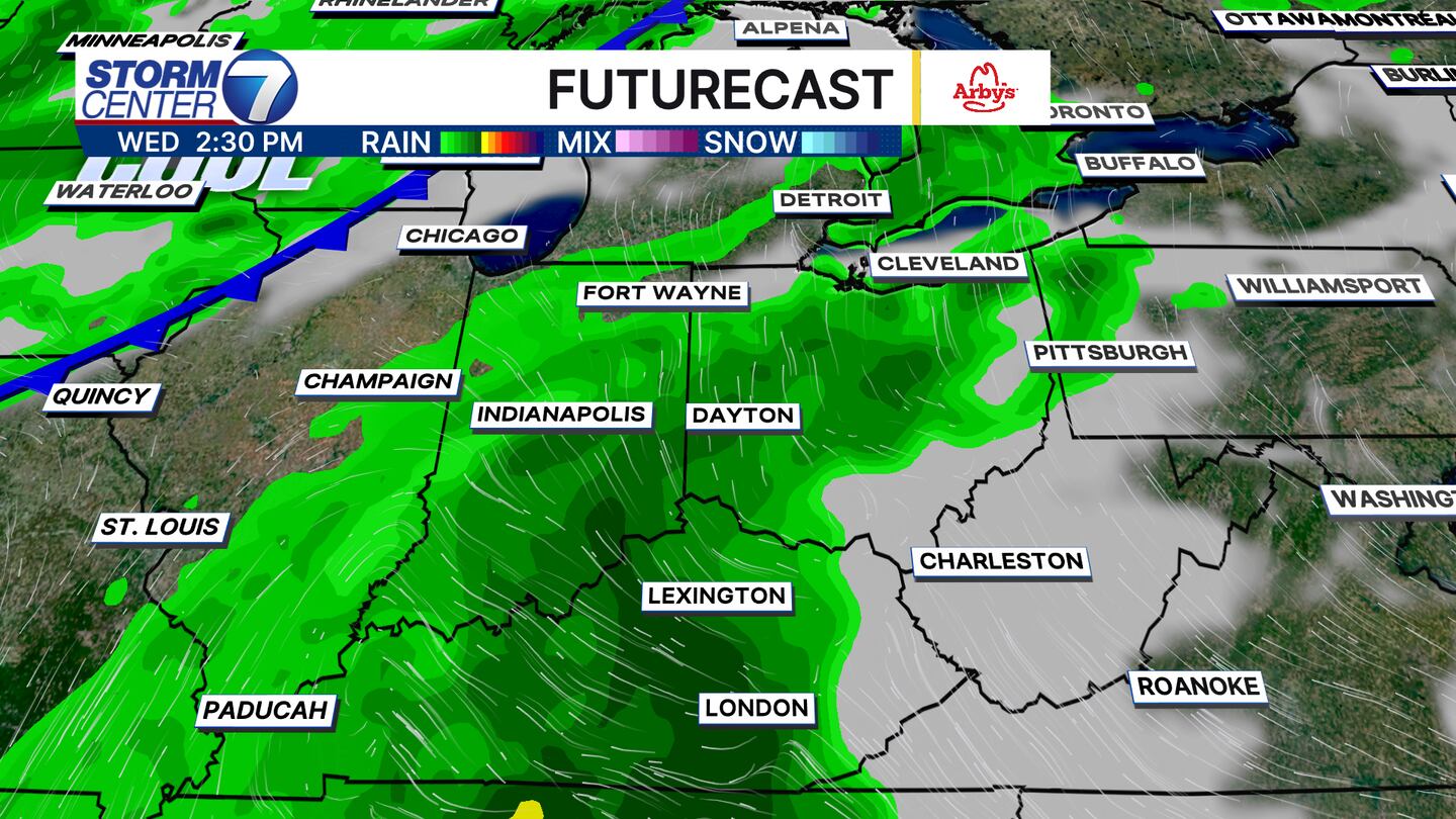
The best chance for widespread showers and perhaps a few thunderstorms will return by Wednesday. A few showers could arrive as early as Tuesday evening, but the rain gear will definitely be a need by Wednesday.
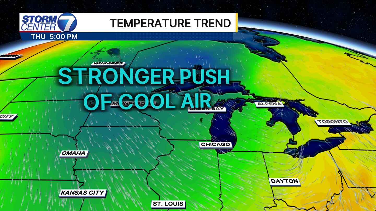
Behind this cold front, a stronger push of Canadian air arrives and takes us 15 degrees below normal by Thursday with highs only in the 60s. We could even set a record for the coolest high to ever occur on September 4th.
[WATCH Storm Center 7 Weather on the following devices]
For those who like cooler temperatures, we are likely to stay below normal through at least next weekend! Rainfall totals this far out can be a bit tricky, but I do see a chance for at least one-half inch of rain between Wednesday and Thursday to help water the crops, lawns, and gardens. Have a fantastic weekend!
 Sign Up

