
DAYTON, OH — Hurricane Erin has generated lots of buzz on social media over the past few days!
The storm went from a tropical storm to a Category 5 hurricane in less than 24 hours.
The storm has gone through an eyewall replacement cycle where a new eye forms around the existing eye.
This allows for the storm to weaken a bit and can cause some wobbling in the storm movement, which was observed today.
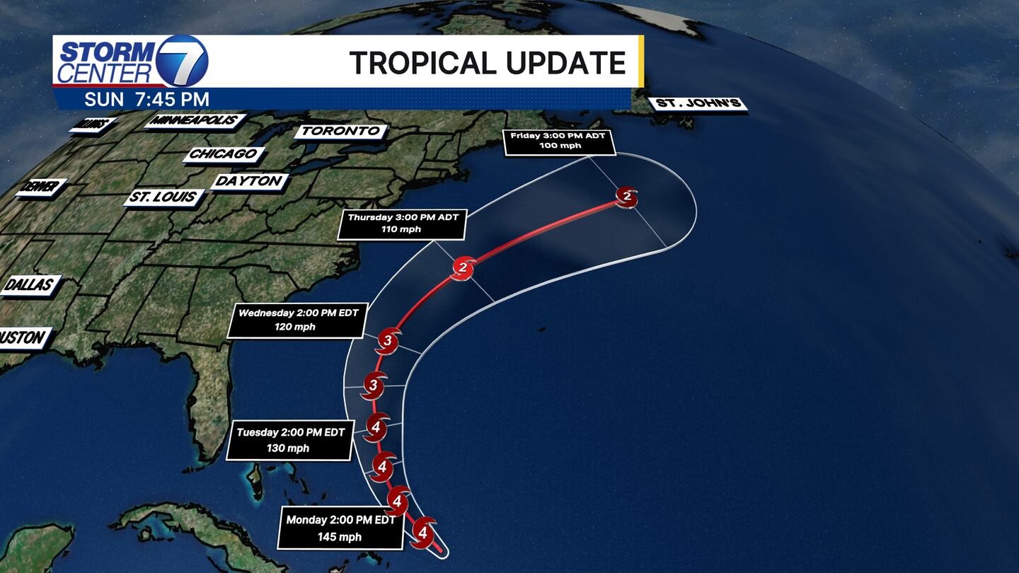
Erin is set to continue a gradual northwest turn. There have been some westward shifts in the forecast, but the consensus remains that Erin stays away from the United States directly. Erin will grow in size by midweek as the wind fields expand. This will bring some tropical storm force gusts to the North Carolina coast in particular, along with high waves.
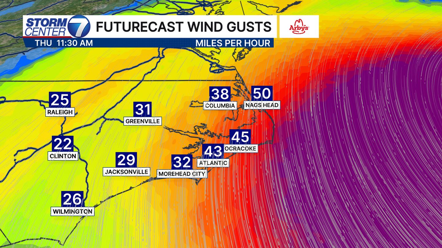
Tropical storm force winds start at 39 miles per hour, and some spots in the Outer Banks of North Carolina could see gusts to 50 miles per hour. Impacts from tropical storms can extend far away from the center. Just because the storm is not expected to make landfall does not mean some sort of impacts can not be felt hundreds of miles away.
Erin is not the only thing we are watching! A tropical wave moving off the African coast has a 40% chance of development into a tropical system over the next seven days, according to the National Hurricane Center.
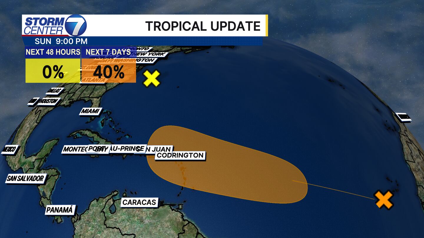
The next name on the list for the Atlantic Basin is Fernand. This list of names rotates every year. It remains to be seen just how organized the wave moving away from Africa can organize, but we will watch it closely!

©2025 Cox Media Group


 Sign Up

